Bageshwar
Bageshwar, 1908
This article has been extracted from THE IMPERIAL GAZETTEER OF INDIA , 1908. OXFORD, AT THE CLARENDON PRESS. |
Note: National, provincial and district boundaries have changed considerably since 1908. Typically, old states, ‘divisions’ and districts have been broken into smaller units, units, and many tahsils upgraded to districts.Many units have since been renamed. Therefore, this article is being posted mainly for its historical value.
Village in the District and tahsil of Almora, United Provinces, situated in 29 51' N. and 79° 48' E., at the confluence of the Sarju and GomatI, which form a tributary of the Kali or Sarda. Population fluctuates considerably, and is about 800 in the autumn. The village was formerly a great trade centre for the exchange of the produce of Tibet with that of the plains and also imported goods, but the Bhotia merchants now travel to the submontane marts. Bageshwar is also a place of pilgrimage, and contains a temple built about 1450, but an older inscription records a grant to a temple here by a Katyiiri Raja. There are some curious tombs made of tiles, which are assigned by tradition to Mughal colonies planted by Timiir. A dispensary is maintained, and there is a small school with 24 pupils.
Sunderdhunga glacier
2024: Baba builds temple
July 16, 2024: The Times of India

From: July 16, 2024: The Times of India
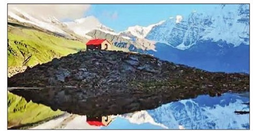
Bageshwar : A self-styled godman quietly built an unauthorised temple on govt land at a height of over 5,000 metres (16,500 feet) on the Sunderdhunga glacier in Bageshwar district, Uttarakhand. Baba Yogi Chaitanya Akash claimed to have received divine instructions to construct the temple at the eco-sensitive spot high up in the mountains.
Mahendra Singh Dhami, a villager, said, “The Baba convinced villagers to support the project, saying Devi Bhagwati appeared in his dream and directed him to build the temple at Devi Kund. The kund, a sacred spot for locals, has been turned by this man into a swimming pool. He can often be seen bathing there. This is desecration.” Caught napping, the local administration has now launched an investigation into the unauthorised construction.